|
Mills in Colonial Cities
Introduction
Since windmills and watermills were crucially important to the survival
of early settlements, it is not surprising to see cities growing
up where mills were built. Although later city development has often
eclipsed this crucial early form of development, often remnants of
these early industries are preserved in the names of streets such
as Mill Street, Race Street (the race was the small canal that
fed water to the mill), or Pond Street.
 If you look around your own town, if there is any flowing source of water
at all, it is virtually guaranteed that you will find a street named
after a mill or its industry (like sawmill road, or paper street
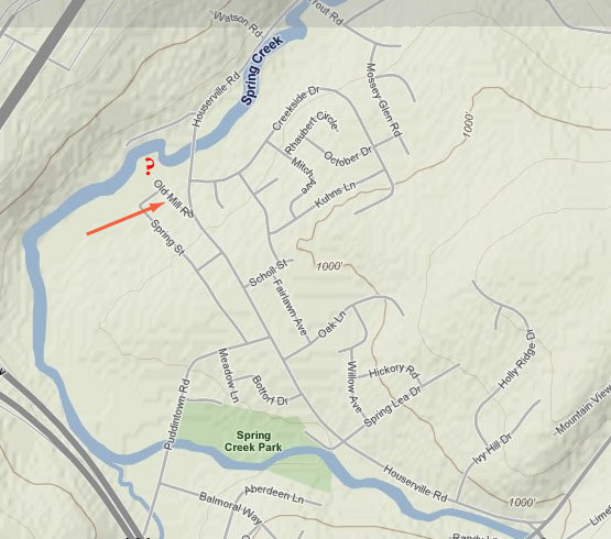
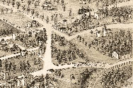
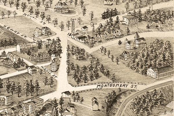
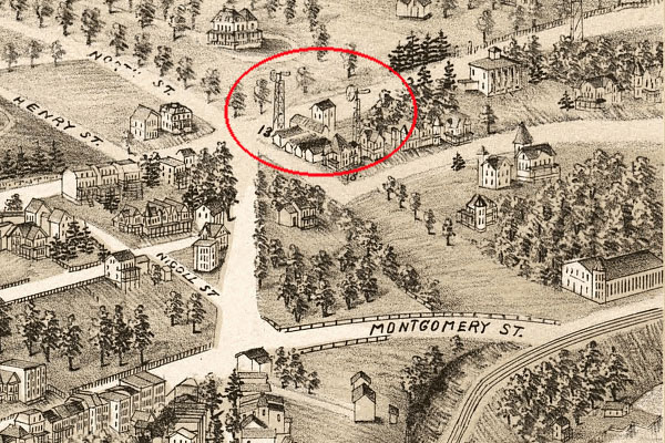
where a paper mill once stood). The image to the right, for example,
is from the little hamlet of Houserville, PA. Although you probably
don't know the history of the town, you might guess that Old Houserville
Road was the original road along the creek when the area was settled
(in this case in the late 18th century). And the fact that there
is an Old Mill Road right by a bridge pretty much guarantees that
there was a mill here and that the modern bridge is where the old
dam was (roads often crossed streams on top of the dam). You should
be able to encourage students to make deductions like this at the
first pass, and then send them out on to the web to find out the
details of the history of the place you are looking at.
If you look around your own town, if there is any flowing source of water
at all, it is virtually guaranteed that you will find a street named
after a mill or its industry (like sawmill road, or paper street
where a paper mill once stood). The image to the right, for example,
is from the little hamlet of Houserville, PA. Although you probably
don't know the history of the town, you might guess that Old Houserville
Road was the original road along the creek when the area was settled
(in this case in the late 18th century). And the fact that there
is an Old Mill Road right by a bridge pretty much guarantees that
there was a mill here and that the modern bridge is where the old
dam was (roads often crossed streams on top of the dam). You should
be able to encourage students to make deductions like this at the
first pass, and then send them out on to the web to find out the
details of the history of the place you are looking at.
You can use numerous mapping software like Google
Maps, Yahoo
Maps, Mapquest, or MapBlast to
find these streets. Or you can teach the students about topographical
mapping using TopoZone.
Of course, if you do not know the name of the street you are looking
for, though, these online search engines are not always as useful.
Better to sit down with an old roadmap and follow the rivers and
see where mill streets intersect with them. Alternately, you could
get a gazetteer from the library to search for names.
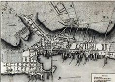
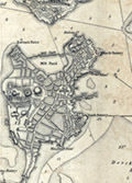
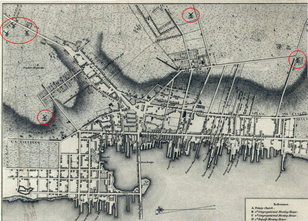
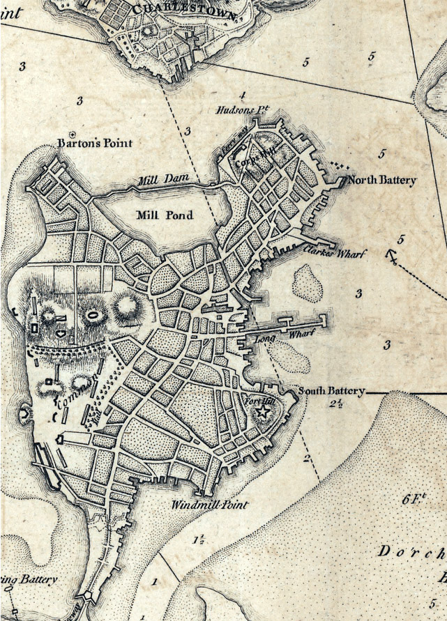
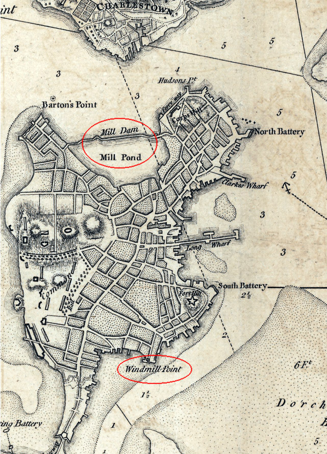
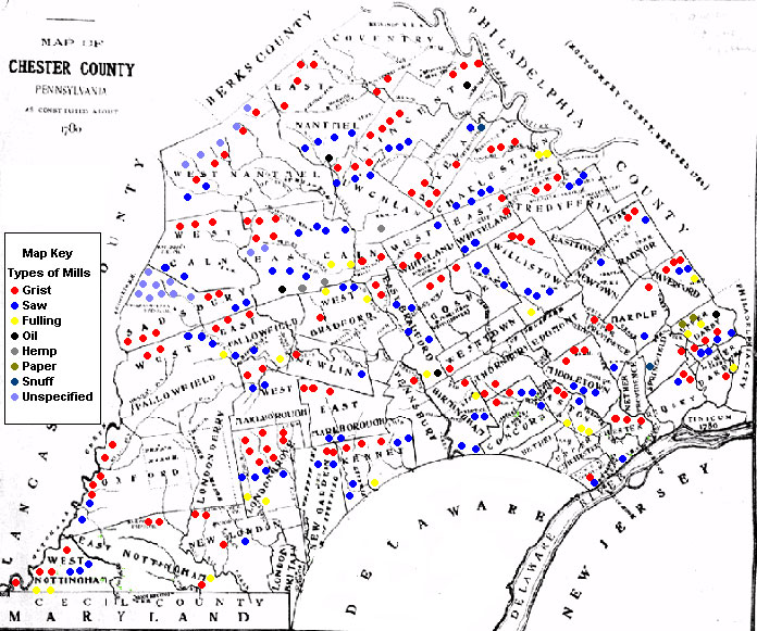
IMAGES
Below are early maps of early colonial cities. The larger versions are available in two forms, plain or with the mills highlighted.
*Images from the Library of Congress American Memory maps division.
Discussion Questions
Return to:
One-Minute Essays
 |
||||||||||||||||||
|
|||||||||||||||||||
 Jump to:
.jpg)
.jpg)